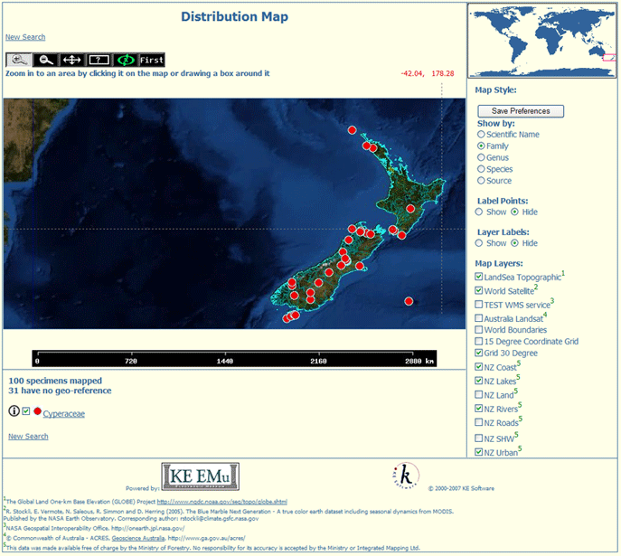
EMu has a utility to plot the location and distribution of data (typically specimens) on maps. Web Maps can be accessed in a web browser (launched from within EMu or directly from a URL):
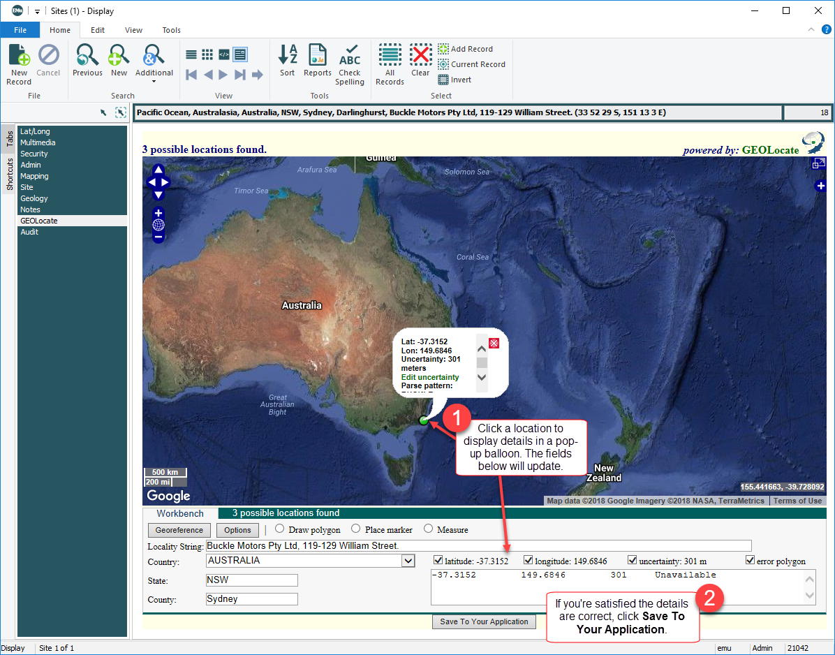
It can also be accessed in the EMu client itself. The Sites module, for instance, can include a GEOLocate tab that displays Web Maps:
Web Maps is interactive and dynamic, with data sourced directly out of EMu.
Web Maps can be implemented in several ways:
- A web-based client (perhaps integrated into a website) directly sourcing data from an EMu system. See How to use the Web Maps interface for details.
- Directly out of an EMu client. In this case Web Maps is generated by running a special report on data directly in the EMu application: this will open a web browser to display Web Maps. See How to access the Web Maps web interface from EMu for details.
- Within EMu itself - the Sites module, for instance, can include a GEOLocate tab that displays Web Maps.
 How to use the Web Maps interface
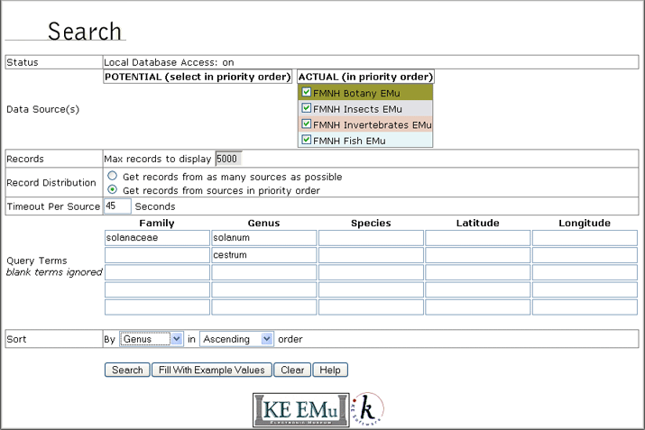
In this example we search for records with:
- A Family value of Solanaceae AND a Genus of Solanum
- OR with a Genus of Cestrum
- Select the data sources that you wish to search.
Note: The order in which the data sources are selected determines the priority in which they are searched. In other words, if there are four data sources listed and you want the last one in the list to have priority in the search, select it first.
Note: Web Maps is designed to search local databases.In this example we select the FMNH Botany EMu checkbox (and just to demonstrate the priority ordering of data sources, we then select FMNH Insects EMu, FMNH Invertebrates EMu and FMNH Fish EMu).
- Specify the maximum number of records to display.
The default is 80. In this case we enter
5000. - At Record Distribution, select (or accept if it is the default setting) Get records from sources in priority order.
- Specify a Timeout Per Source.
The default is 45 seconds and in this case we won't change that.
- In the first row of the Query Terms table, enter
Solanaceaein the Family cell AND Solanum in the Genus cell.In the second row, enter
Cestrumin the Genus cell. - Select Genus in the Sort By drop list.
The results will be sorted in alphabetical order by Genus:
- Click the Search button.
The Distribution Map page displays.
Each of the selected data sources will be searched simultaneously up to the maximum timeout (45 seconds). The display of records is determined by:
- The priority order of the data sources (FMNH Botany EMu has priority over FMNH Insects EMu for instance)
- The Record Distribution option and maximum records to display setting.
In this case the Search results will be listed first from FMNH Botany EMu up to 5000 records. If less than 5000 matching records are found in the FMNH Botany EMu data source, matching records from the next data source will be listed, and so on until all matches are returned up to a maximum of 5000.
In this search, records that contain both
SolanaceaeANDSolanum(the record must contain both words, not just one of them)ORwhich containCestrumwill be located.
How to access the Web Maps web interface from EMu
Accessing Web Maps from within EMu is as simple as:
- Searching the Catalogue or otherwise listing one or more specimens to map (retrieving a group, for instance).
- Selecting the specimens to be mapped (or mapping all specimens listed).
- Running the Web Maps report.